RACAS® Condition Assessment for QLD Parks & Wildlife Service

Project Overview

Over a two-year partnership, SHEPHERD worked with Queensland Parks and Wildlife Service (QPWS) to assess and condition-rate more than 1,490 kilometres of unsealed road across 30+ national parks, islands, and remote conservation areas. QPWS now have a comprehensive, consistent view of their road assets – empowering better valuation, clearer access planning, and more targeted response in disaster-impacted zones.

Scope of Work

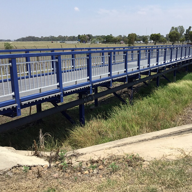
  • Road condition assessments for unsealed access tracks, park roads, and marine/island networks
  • Coverage included Stradbroke Island, Boodjamulla, Curtis Island, Thursday Island, Norfolk Island, and dozens of mainland park sites
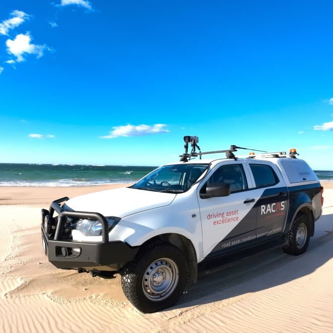
  • Surveys conducted using RACAS®
  • Integration with Parks’ internal systems for revaluation and future maintenance programming

Key Stats

📍 1,490km surveyed over two years
📍 326km captured in 2025 alone
📍 30+ park and island locations
📍 1 consolidated condition dataset across the QPWS road network
📍 Condition ratings aligned with valuation needs and DRFA evidence

Project Outcomes

Asset Revaluation Confidence
Detailed, consistent condition data for QPWS unsealed road assets ensured accurate and defendable comprehensive valuations.

Maintenance & Capital Works Planning
Engineers and planners now have a clearer picture of where to invest in re-sheeting and repairs -especially across remote and seasonal access roads.

Disaster Response & Recovery
In flood-impacted areas like Boodjamulla, RACAS® helped assess damage quickly after access was restored, supporting DRFA claims and fast-tracking recovery.

Visibility Across the Organisation
From engineering to finance, QPWS staff now access a single source of truth for road condition -bridging gaps between technical teams and funding decisions.

📍 Project highlight:
A truly unique dataset capturing the scale and complexity of Queensland’s natural asset network-powered by RACAS®, delivered by local engineers, and trusted by QPWS.

RACAS® = Real Tech. Real Engineers. Real Results.

Banana Shire Council Comprehensive Revaluation

Banana Shire Council (BSC) engaged SHEPHERD to undertake a Comprehensive Revaluation for Roads, Airports and Drainage assets. This being the second engagement from BSC to complete the comprehensive valuation.

Our project objectives were to:

  • Complete a comprehensive verification between asset data held in Assetic and mapping held in MapInfo
  • Review unit rates and useful lives
  • Produce valuation documents.

The verification stage got underway early, with recent aerial imagery we were able to verify kerb and footpath dimensions. With the use of our RACAS system, we drove the entire road network and ensured all surface types were accurately represented in Council’s data. This data was condition modelled and included in the valuation.

As the construction knowledge retained by Council is high, we were able to utilise recent construction costs for unit rates and verify these based on first principles.

One exciting aspect of the project was the involvement from whole of Council. Our team went to site to discuss unit rates and useful lives. We had a full cast of staff from finance, engineering and assets to comprehensively review calculations.  We also completed onsite inspections of the oldest assets to assist in verification of useful lives of kerb, footpaths, and drainage assets.

We were also onsite for the Renewal Modelling project to discuss service levels and interventions, this discussion with Council staff enabled service levels to be included for Roads into the valuation to ensure what is occurring in the field is represented correctly in the office and financials.

Feeding all the asset data and revised rates into the valuation model enabled Council and SHEPHERD to have in-depth discussions regarding the impacts that occurred. This also gave Council time to review all valuations and complete verification processes.

SHEPHERD were onsite to answer all questions regarding the processes undertaken, and the in depth methodology documentation. Delivery included a comprehensive workbook that utilises pivot tables for interrogation and also producing basic renewal graphs and also a comprehensive valuation methodology document.

Moving Forward: With an accurate representation of BSC’s asset stock through this comprehensive valuation, and applying suitable service levels, Council will be able to complete in-depth financial reporting that directly feeds into Strategic Asset Documentation. This documentation will assist in funding future renewal works to ensure the region’s communities are well maintained.