

Adapted from a presentation by Justin Fischer, General Manager – Client & Corporate at SHEPHERD, at the IPWEA NSW & ACT State Conference 2025.
When disaster hits, councils need to move quickly. But moving quickly is not enough.
Critical roads need to be inspected, damage needs to be understood, funding submissions need to be prepared, and communities need confidence that recovery works are progressing. At the same time, councils must meet the evidence, assurance and eligibility requirements that sit behind Disaster Recovery Funding Arrangements.
For council leaders, the challenge is not simply speed. It is speed with control.
Traditional manual approaches can make that difficult. Inspections can take time, information can sit across disconnected systems, and teams may struggle to clearly demonstrate pre-event and post-event condition when funding decisions depend on defensible evidence.
In a disaster recovery environment, delays in evidence often become delays in approval, funding and reconstruction.
Why traditional DRFA processes struggle
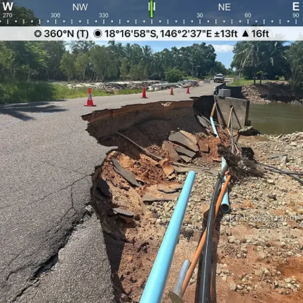
DRFA submissions rely on clear and traceable evidence of damage, eligibility and proposed treatment.
For councils already under pressure, common challenges include:
- time-consuming manual inspections
- fragmented data across multiple systems
- limited visibility of pre-event condition
- stretched internal resources during peak response
- difficulty turning field information into consistent submissions
These challenges do not just affect administration. They can slow down recovery timelines and increase the risk of rework, funding questions or approval delays.
When communities are waiting for access, safety and connectivity to be restored, that matters.
A smarter way to collect and use evidence
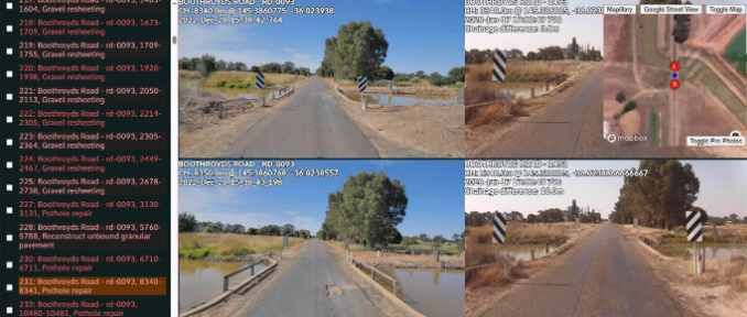
SHEPHERD’s approach brings together RACAS®, AI-supported defect identification and GIS-based platforms to streamline the disaster recovery process from assessment through to delivery.
The aim is not technology for its own sake. It is to create a clearer, more defensible evidence base that councils can use to make decisions, support funding submissions and plan reconstruction works.
This includes GPS-tagged imagery, metadata-rich records, side-by-side condition comparisons and mapping tools that help teams see the network clearly. It also supports treatment logic aligned with state authority standards, so evidence can move more efficiently from the field into the funding and delivery pathway.
The result is a single trusted dataset that can support multiple outcomes, including emergency response, DRFA submissions, asset management, prioritisation and delivery planning.
That reduces duplication and gives council teams a clearer line of sight from damage evidence through to scope, approval and works.
Where AI adds value
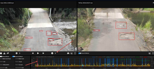
AI can play an important role in disaster recovery, but it should not replace professional judgement.
Used well, AI helps inspectors identify potential defects faster, improves consistency and reduces time spent on the road. This can support both efficiency and safety, particularly when councils are dealing with large networks or widespread damage.
Its value is strongest when paired with:
- high-quality road imagery
- clear reporting formats
- consistent review processes
- engineering judgement
- practical knowledge of DRFA requirements
In that context, AI becomes a support tool, not a shortcut. It helps teams work faster while maintaining the evidence and review needed to support compliance and defensibility.
Results from regional councils
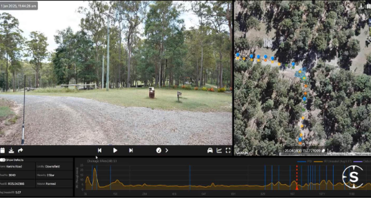
The benefits of this approach are already being seen across regional Australia.
Following a major rain event, Gympie Regional Council captured more than 3,000 damage points across a 2,300 kilometre road network within days. That allowed priority works to be identified early and funding submissions to be lodged within the first month.
At Cassowary Coast Regional Council, after Ex-Tropical Cyclone Jasper, $36 million in DRFA submissions were prepared in under three months, achieving a 93% average approval rate. Reconstruction was well underway before the next wet season.
These outcomes show what is possible when councils have the right evidence, systems and processes in place.
Recovery starts before the next event
One of the clearest lessons is that disaster recovery does not begin after the rain stops.
Councils with strong pre-disaster condition data are better positioned to demonstrate what changed, support eligibility, reduce disputes and move through funding processes faster. They are also better placed to keep control of delivery, reporting and community expectations as recovery progresses.
Prepared councils do not need to rebuild the evidence base under pressure. They can focus on the work that matters: restoring access, repairing critical infrastructure and helping communities recover.
At SHEPHERD, we support councils to connect road imagery, asset evidence, DRFA requirements and delivery planning through practical systems built for real-world recovery.
If your council wants to strengthen its DRFA readiness before the next event, SHEPHERD can help establish the evidence, systems and processes needed for faster, more defensible recovery. Get in touch at info@shepherdservices.com.au
Key Takeaways
★ Better DRFA outcomes start with better evidence.
★ One dataset can support funding, planning and delivery.
★ AI helps when paired with expert review.
★ Prepared councils recover faster.
★ Real results are already being delivered.