

Following the January 2026 flood event, Isaac Regional Council engaged SHEPHERD to undertake engineering assessments across part of its road network and support the preparation of DRFA submissions. Because Council already had a mature business-as-usual road management foundation in place, the response was able to move quickly from post-event inspection to evidence-based submissions.
The Challenge
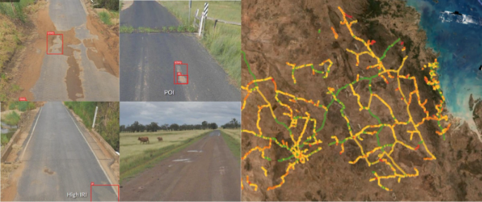
Isaac Regional Council manages a large and diverse road network, including around 4,500 km of roads and approximately 2,100 km of unsealed roads. These roads support rural residents, mining, agriculture, freight, tourism, school buses and emergency access, making road management decisions both operationally important and highly visible to the community.
When flooding impacted the region, Council needed to answer several critical questions quickly: what was the pre-event condition, what had changed, where was the damage, what was eligible, what treatment was appropriate, and what evidence would support each submission?
Post-event evidence only tells half the story. Council needed a clear comparison between pre-event and post-event condition to support defensible recovery decisions and funding claims.
The Solution
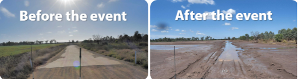
SHEPHERD mobilised to support the immediate response and engineering assessment phase, using Council’s existing road management foundation alongside post-event inspections and RACAS® data.
Across the assessed network, SHEPHERD captured and reviewed:
- 1,040 km captured and assessed post-event
- 10,490 POIs logged in RACAS® post-event
- 2,956 damages and treatments assessed
- More than $38M in damage identified
- 54 inspector days, completed by two inspectors across 27 days
- 16 days total treatment logging period, completed concurrently
From mobilisation to submissions lodged, the process took less than eight weeks.
Across the five submission packages assessed to date, including Priority Roads 1 and 2, Unsealed Zones 2 and 4, and Culverts and Structures, $32.69 million was originally submitted, with $30.17 million approved and $2.52 million deemed ineligible. This represents an ineligible rate of 7.7%.
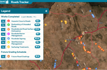
The work was supported by Isaac’s existing road intelligence, including network extent and location, Road Use Index context, condition history, IRI, imagery, mapping, inspection discipline and community-facing communication tools.
What We Did Differently and Why It Mattered
This project did not start with a blank map.
Isaac Regional Council had already invested in a stronger business-as-usual road management approach, including structured inspections, service-level thinking, roughness-based intervention triggers, budget scenarios and more consistent network data.
When the flood event occurred, that baseline became critical. It allowed Council and SHEPHERD to compare pre-event and post-event condition, validate damage, identify appropriate treatments and prepare submissions backed by clear, geo-referenced and reviewable evidence.
This reduced reliance on memory, avoided reconstructing evidence after the event, and gave Council a stronger basis for discussions with assessors and funding agencies. SHEPHERD’s role was to help turn that existing foundation into a practical recovery workflow. By connecting RACAS® data, field assessment, damage validation, treatment records and submission requirements, Council had a clearer line between the event, the damage, the recommended treatment and the funding claim.
The value was not just speed. It was structured evidence, captured at scale, that supported a faster and more defensible recovery process.
Delivered in Partnership

Thank you to Isaac Regional Council for the trust placed in SHEPHERD during the immediate response and engineering assessment phase.
This project shows the value of building strong road management foundations before they are needed. By maintaining reliable data, practical systems and a clear understanding of network priorities, Council was able to move quickly under pressure and support recovery decisions with confidence.
The work also reinforces a broader lesson for regional councils: disaster readiness does not start when the rain stops. It starts with the evidence, systems and processes built into everyday road management.